Best Trailheads Near Gunnison and Crested Butte
Explore trailheads close to town in Crested Butte and Gunnison in this hiking guide:
______________________________________________________________________________________
Come to the Gunnison Valley for your hiking trip and take advantage of the best trailheads near Gunnison and Crested Butte. One of the benefits of visiting the Gunnison Valley includes easy access to trails. You could fill several days with hikes that are just a walk or bike ride away from town. Many of the trailheads close to Gunnison and Crested Butte are also excellent mountain biking trails—ride to world-class trails right from your front door. Whether you’re looking for a quick hike, want to take the kids out or are short on time, this list of trailheads near Gunnison and Crested Butte will help you explore.
Why are there trails so close to Gunnison and Crested Butte?
Over two million acres of the Gunnison Valley is protected, public land. This allows easy access to trails and a variety of hikes to explore.
Trails close to Crested Butte
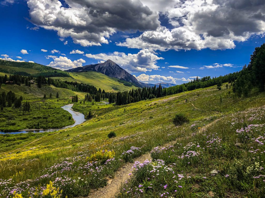
The Rec Path
Though not a traditional hike, this 4.6-mile paved path is walkable from town and offers stunning views of Crested Butte and Mt. Crested Butte. It begins in Crested Butte on Ninth Street. In Mt. Crested Butte, it begins on the sidewalk in front of Treasury Liquors and The Store.
The path cuts through wildflower fields in the summer and has sweeping views of golden aspen trees in the fall. You can use it just for a stroll, or to access trails like the Crested Butte Mountain peak hike or Snodgrass Trail. The Rec Path is also open to bikes.
Peanut Lake
The Peanut Lake trailhead is located at the end of Butte Avenue in Crested Butte. Lower Loop and Woods Walk are accessible from Peanut Lake. Both trails are also open to bikes—expect smooth trails and low-angle trails in this zone.
Lower Loop
Lower Loop is an easy hike that is about seven miles round-trip. The trail meanders through meadows and along the Slate River. Your hike will also give you views of Crested Butte Mountain, Gothic Mountain and the Elk Mountains. Take Peanut Lake Road past an old mining structure called the Gronk. At the end of the road, bear right as the trail snakes through trees and past some benches. Continue bearing right to stay on Lower Loop. Take a left at Gunsight Pass Road and follow the switchbacks. The trail continues on the left and connects to Upper Lower Loop. Bear left at the Budd Trail junction until the trail intersects with Lower Loop. Complete the whole loop or turn back at any time.
Woods Walk
Woods Walk is the closest trail to town in Crested Butte. It connects to Lower Loop Trail and Bud Trail for a longer hike. This easy hike is 2.9 miles long. The first quarter mile goes through an aspen grove before opening up to views of Crested Butte Mountain, Gothic Mountain and Peanut Lake. Follow the trail into a valley with an aspen grove to the left. Finish the loop or connect to Lower Loop or Budd Trail.
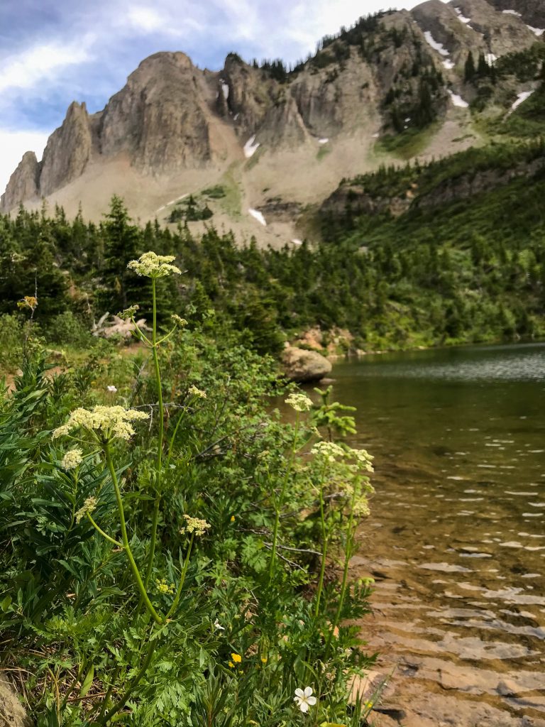
Green Lake
This stunning lake nestled at the base of Mt. Axtell feels like it’s tucked deep in a wilderness area, but it’s actually just four miles from downtown Crested Butte.
The Green Lake trailhead is near Crested Butte, behind the Crested Butte Nordic Center. It’s a moderately difficult nine mile out-and-back hike. The hike starts at the Nordic Center. Head southeast on the doubletrack behind the building. Take a right at the road and walk for about half a mile to the Green Lake trailhead.
The hike begins with a climb, which continues practically the whole hike. Switchback through dark timber to another road. Walk on the road for about half a mile until joining back with the trail on the left. Keep winding through dark timber until the trail opens up. Stay straight at the intersection with Carbon Creek trail to get to the lake.
Trails close to Mt. Crested Butte
Snodgrass Trail
Snodgrass Trail is an easy-to-moderate 5.8-mile out-and-back trail. The trailhead is 1.8 miles from Crested Butte Mountain Resort in Mt. Crested Butte. The hike begins with a steep climb that offers wide vistas of Crested Butte Mountain, the Elk Mountains and the south end of the valley. Stay left on the trail over undulating hillsides for panoramic views of Crested Butte Mountain and Whetstone Mountain. The last part of the trail winds in and out of aspen groves. Snodgrass is also a popular mountain biking trail.
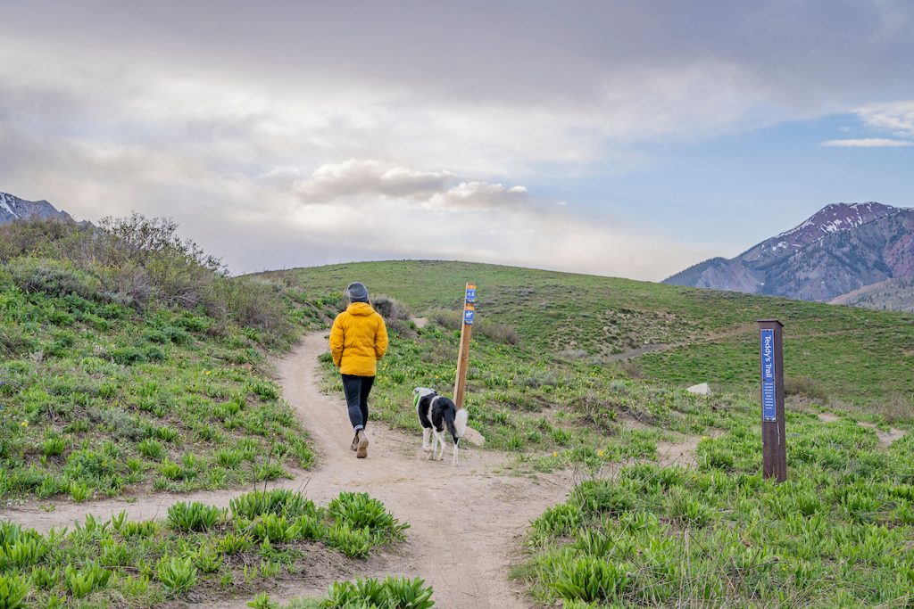
Teddy’s Trail
Teddy’s Trail is also accessible from the Snodgrass trailhead. This easy trail is 1.8 miles round trip. It begins to the right of the Snodgrass hike. A sign indicates the trail for horses and the trail for hikers and bikers. Take the hiker trail.
The trail wraps around hillsides dense with wildflowers and a beautiful view of the Gothic Valley. Walk past a pond into an aspen forest. Stay left here for a mellow trail, or head right for a steep climb to Snodgrass Trail. Either option eventually meets back up with Snodgrass Mountain Trail and back to the trailhead.
Crested Butte Mountain peak hike
Hike to Crested Butte Mountain’s peak in summer and fall. This hike begins at the base area of Crested Butte Mountain Resort (CBMR). To reach the summit, you can hike from the base area or ride the Silver Queen lift. CBMR is also a downhill bike park in summer and fall. Over 30 miles of lift-served singletrack are accessible via the Red Lady Express Lift.
From the base: The hike from the base area is about 11.25 miles round-trip and strenuous. Start on Up and Away Trail and follow it to Painter Boy Road. Pass Painter Boy lift to the trail Primer and hike up to Red Lady lift. Head to the Upper Mountain Access Trail/Silver Queen Road from Red Lady. Follow the road and switchbacks to Paradise lift and Silver Queen lift.
Take a break at the scenic overlooks along the switchbacks. The last push to the summit involves some scrambling. Tread carefully. Once at the top, the 360-degree views of the Gunnison Valley and the Elk Mountains are stunning.
From the Silver Queen lift: The Silver Queen lift offers scenic rides throughout the summer and fall. You must purchase a lift ticket to ride. Once you get off the lift, scramble about two miles to the summit.
Upper Loop
This moderate hike is 1.5 miles point to point. The north end of the trail begins on Hunter Hill Road in Mt. Crested Butte. The trail follows the west flank of Crested Butte to the south through aspen groves and rock gardens. The trail ends at Brush Creek Road. Enjoy views of Whetstone Mountain to the west as you hike or bike. The Upper Loop is a particularly good trail for mountain biking because it can be linked to so many other nearby trails, including Happy Hour, Tony’s, Upper Upper and Pointed Laccolith.
Trails close to Gunnison
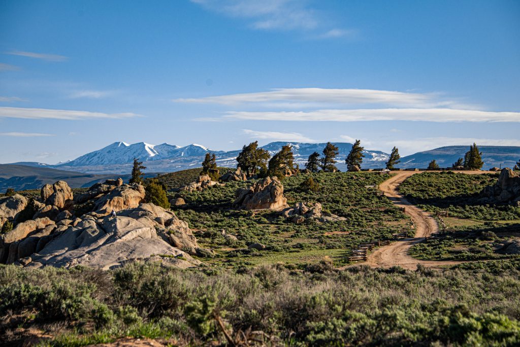
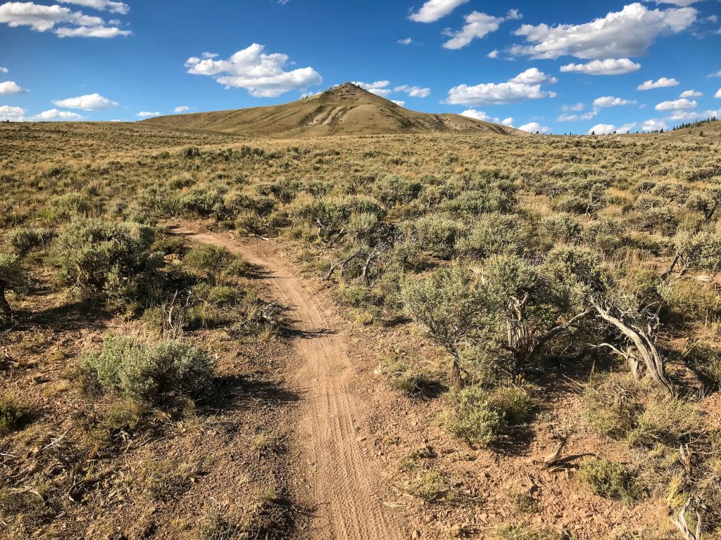
Hartman Rocks
Hartman Rocks is about four miles from downtown Gunnison. This multi-use area is popular with mountain bikers and dirt bikers. Many mountain bikers choose to ride here from town rather than drive, since the road is fairly flat and quiet.
Though close to town, the trails at Hartman Rocks feel otherworldly. The granite rock formations, sweeping fields of sagebrush, and long ridges offer scenic and interesting hiking. Hikes at Hartman Rocks include Jack’s Trail and Bambi’s and Sawtooth Loop. Learn about these hikes and more favorite hikes at Hartman Rocks.
Signal Peak
The Signal Peak trail system is located across the street from Western Colorado University next to the Mountaineer Bowl. These trails are popular with mountain bikers, trail runners and dog walkers. Hikers can take advantage of this area for hikes close to town.
There are 20 plus miles of trails at Signal Peak. Get in a quick hike on a short trail or connect trails for a long loop or out and back. There is not much shade at Signal Peak. Bring sun protection and lots of water.
Canal Trail to Contour Trail
Canal Trail begins at the trailhead next to the Mountaineer Bowl. It connects to Contour Trail, which switchbacks across the front of Signal Peak. Hike up to the water towers for a short hike with a scenic view of Gunnison, the mountain peaks to the north, Tomichi Dome to the east and Hartman Rocks to the west. Contour Trail also connects to Southern Cross, Broadcaster and Rasta Gulch. View the map of Signal Peak for more trails.
Van Tuyl
Van Tuyl Ranch is a 3.1-mile loop in Gunnison. This wide gravel trail is flat with a small, gradual incline. The exposed trail offers views of grassy meadows, W Mountain and the Palisades. Part of the trail runs parallel to the Gunnison River. Dip your feet in to cool off and wave to passing anglers and boaters.
Van Tuyl is equipped with bathrooms and benches. It can get buggy in the summer, so bring bug spray. Wearing a hat and sunscreen are also recommended. This trail is also a great mellow bike ride.
Hiking Etiquette
Trailheads near Gunnison and Crested Butte tend to be popular. Keep these tips in mind while hiking:
- Uphill hikers have the right of way. Downhill hikers should give them space to pass. Bicyclists yield to hikers. Hikers and bikers yield to horses and pack animals.
- Make your presence known to other hikers with a friendly greeting.
- Don’t go off trail. This can cause damage to the vegetation and environment.
- Never feed or disturb wildlife. Respect them by maintaining your distance.
- Don’t hike or bike on muddy or wet trails. If you do encounter mud, go through it and not around it to avoid causing erosion and damage on the trail.
- Don’t play music while hiking. This can disturb wildlife and other hikers.
- Come prepared with plenty of water, snacks and sunscreen. Bring layers and have a plan in case the weather turns inclement.
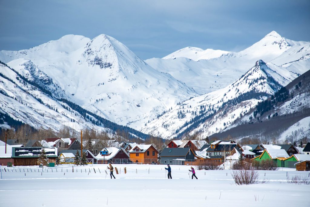
Winter trails close to town
Many summer trails are also open for winter recreation. The Crested Butte Nordic Center has trails for Nordic skiing, fat biking and snowshoeing that begin right in town. Gunnison Nordic Club grooms Hartman Rocks and Van Tuyl for Nordic skiing and snowshoeing. Hartman Rocks is one of the best areas for fat biking in the Gunnison Valley. Gunnison Trails grooms Hartman Rocks for fat biking.
More hiking in the Gunnison Valley
History buffs can explore these hikes to Colorado’s abandoned mining camps. Take in more than the mountain scenery on a wildlife hike or wildflower hike. Get started on planning a hiking trip with this sample hiking trip itinerary.
Plan a trip
Use our trip planning guide to book flights, find a place to stay and explore other things to do.
