Hike to Colorado’s Abandoned Mining Camps
Learn about hikes that take you back to the Gunnison Valley’s mining history:
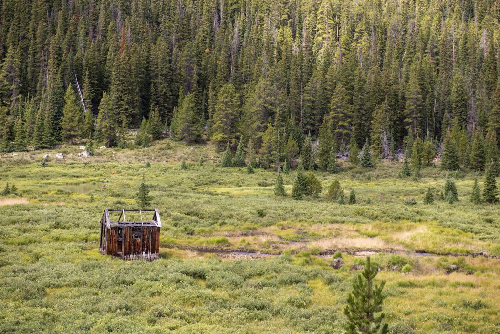
The Gunnison Valley owes its present success to the mining days of the past. Crested Butte was established as a silver and coal mining hub, and Gunnison functioned as a supply stop for Crested Butte. Miles of trails near abandoned mining camps give hikers a glimpse into the Gunnison Valley’s past.
- Old cabins, mining equipment and mining shafts remain in the wilderness around Crested Butte and Gunnison.
- Keep yourself safe and never enter an old mining structure. They are precarious and can emit toxic gas.
- Tincup, the Alpine Tunnel, Crystal Mill and Gothic are some of the most preserved historic mining sites in the Gunnison Valley.
- North Pole Basin, Poverty Gulch and Dasiy Pass are stunning hikes with connections to mining.
______________________________________________________________________________________
Discover the Gunnison Valley’s rich mining history on a hike to Colorado’s abandoned mining camps. Remnants of this past remain for intrepid hikers and history buffs. Around 40,000 people lived in what is now Gunnison and Crested Butte during the 1880s and 1890s, the height of the mining days. Connect with this part of the Gunnison Valley’s past on a hike to an abandoned mining camp to see old cabins, equipment, mining shafts and more.
History of mining in Crested Butte
Crested Butte was originally established as a supply town for more than 15 silver mining camps in the area. However, coal ended up being the more sought-after commodity. Mining for coal and precious metals allowed Crested Butte and the surrounding mining camps to flourish for a few decades.
Much of the infrastructure in the Gunnison Valley was built to provide access to the mines. The communities in the Gunnison Valley today can be attributed to these historic mines. Though nearly all these mines have closed, remains of the past can be seen while exploring the backcountry.
History of mining in Gunnison
Not much mining took place in Gunnison, but the town served as a vital hub for processing and shipping metals. Around 10,000 people lived in Gunnison in 1880. The Denver and South Park railroad arrived around this time as well, increasing access and industry. This provided support for the mines in Crested Butte and the mountains surrounding the area.
Tips for hiking to abandoned sites
Hiking to abandoned mining camps often comes with some danger. Old mining tunnels and structures are not safe to enter. Be smart and explore cautiously.
The best abandoned mining camp hikes in the Gunnison Valley
North Pole Basin
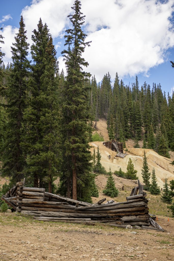
North Pole Basin is a strenuous 8.1-mile out and back hike. This site was once home to North Pole Mine, which extracted silver and copper ore. This trail begins on Rocky Mountain Biological Laboratory (RMBL) and Crested Butte Land Trust (CBLT) land. Stay on the trail and leave your dogs and bikes at home to protect the environment. Mining vestiges from the past include mineral deposits on rocks and old cables.
Get to this hike by driving north on Gothic Road from Crested Butte for 13.2 miles to Schofield Pass. Go over the pass and descend the north side for 1.2 miles. Go past the East Fork Trailhead to a sign announcing the “End of County Maintenance.” Find a place to park and start hiking on the trail that branches left behind the sign.
Along with the historic appeal, this hike is incredibly scenic. Begin the hike by crossing the South Fork of the Crystal River. A gate signals the entrance to RMBL and CBLT land. Admire the view of Galena Mountain around the 1.1 mile mark. Hike though a meadow before crossing an old dam.
The trail, an old mining road, goes past cascading waterfalls and wildflower meadows to the basin floor. Bear right at mile two to ascend Crystal Mountain. In another mile, take a short off-trail route to climb 200ft to the saddle. Catch views of the Maroon Bells, Capitol Peak, Snowmass Mountain and the Elk Mountains. Head back the same way to return.
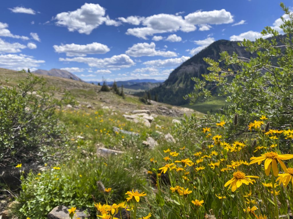
Poverty Gulch and Daisy Pass
This notable wildflower hike should not be skipped by history enthusiasts. Poverty Gulch to Daisy Pass is a challenging 9-mile round trip hike. It begins on an old mining road that goes to the former Augusta Mine. This mine mainly produced gold, but zinc, lead and silver were also found. Old mining equipment can be spotted in the area.
From Crested Butte, head north on Gothic Road and turn left onto Slate River Road after about 0.8 miles. Continue for 7.2 scenic miles, then turn left onto Poverty Gulch Road and carefully cross the Slate River. If you’re not driving a high clearance, four-wheel drive vehicle, it’s best to park before the river crossing and hike in from there.
Start your hike by crossing Poverty Creek, then begin the steady ascent into Baxter Basin. The trail winds through meadows and climbs a series of rocky switchbacks. At the top of Daisy Pass, you’ll be rewarded with sweeping views of Democrat Basin, Oh-Be-Joyful Valley, and the jagged ridgeline of Scarp Ridge.
Crystal Mill from Schofield Pass
Crystal Mill, located in Marble, Colorado, was built in 1892. It was a wooden powerhouse that generated power for a mine. This well-preserved mill is accessible by four-wheel drive or hiking. From Crested Butte, head north on Gothic Road for 15.6 miles. Continue past Rocky Mountain Biological Laboratory and Emerald Lake to go over Schofield Pass.
Parking near the South Fork Crystal River and walking to the mill is recommended as this section of the road is very dangerous for vehicles. The hike from the parking area is moderate and seven miles round trip. Cross a waterfall and walk along the South Fork of the Crystal River for about a mile. The trail descends with some exposure. Pass by Devil’s Punchbowl on your hike.
Cross the river and continue for two miles to a junction with Lead King Basin. Head left for .18 of a mile to the Crystal townsite and Crystal Mill. The mill is on private property but can be viewed from the road. Learn more about Crystal Mill, one of Colorado’s most photographed sites.
Crystal City was established in 1880. It was a booming mining camp with an average population of 500 until 1917, when it became a ghost town. Silver, zinc and lead were mined in the area. In its heyday, the town had a post office, hotels, general stores, saloons and a pool hall.

Peanut Lake
Peanut Mine was a historic coal mine located near Peanut Lake in Crested Butte. The Gronk, a large concrete structure near Peanut Lake, was once part of a mill and tipple operation for Peanut Mine. Peanut Lake is a beautiful scene, but not suitable for swimming due to mining pollution. See Peanut Lake and the Gronk by hiking Lower Loop, an easy seven-mile hike. Get to the trailhead by making a left at the end of First Street onto Butte Avenue in Crested Butte.
The trail begins at Peanut Lake. Follow the loop counterclockwise to the Gronk. Keep going right to continue the loop. Turn around at the benches for a shorter hike or continue Lower Loop. This trail is signed and easy to follow.
At Gunsight Pass, go left and follow the road up some switchbacks. Connect to Upper Lower Trail and then Budd Trail junction before intersecting back with Lower Loop.
More historic mining points of interest in the Gunnison Valley
Cumberland Pass to the Alpine Tunnel
The Alpine Tunnel near Pitkin, Colorado was once the highest railroad tunnel in the world. The tunnel was constructed to connect St. Elmo and Pitkin, as well as provide access for mining operations. Construction took place from 1880 to 1881, and the tunnel was abandoned in 1910 due to damage and harsh conditions. Mining never began before the tunnel closed.
Today, visitors can drive, ride or hike Cumberland Pass to the Alpine Tunnel. A restored telegraph office, turntable and station platform sit along the historic railbed. The tunnel itself is not accessible, but visitors can walk to the entrance and try to imagine what riding a train through the rugged terrain would be like.

Tincup and Mirror Lake
Tincup, Colorado is a former mining town near Taylor Park that was established when placer gold was discovered in the area. Almost all of the structures in town are original from when 1,400-2,000 residents lived there. History enthusiasts will especially enjoy the Tincup cemetery. Read this digitized article originally printed in 1996 to learn more about the cemetery and town.
Though not technically a hike, exploring the town and cemetery on foot allows visitors to admire the historic buildings. Imagine what life might have been like when it was a bustling mining town while walking through town. For a longer hike, explore the perimeter of Mirror Lake, a scenic high alpine lake, at the base on Tincup Pass.
Drive a high-clearance 4WD vehicle or riding an OHV over Tincup Pass is the best way to get to Tincup from Taylor Park. Get to Taylor Park by turning onto County Road 742 from Highway 135. Stay on 135 for about 26 miles before arriving to Taylor Park. Take County Road 765 (Tincup Pass) for about 10 miles to get to Tincup.
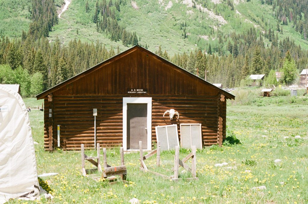
Gothic
Gothic is a historic mining site turned science field station. Three buildings on the campus remain from the founding of Gothic in 1880. Two buildings remain from an attempt to revive mining in 1914. Silver, galena, gold, ruby and pyrite were all found in the area. By the late 1880s, the town’s population was around 1,000.
Today, Gothic is home to Rocky Mountain Biological Laboratory, known locally as RMBL (pronounced like “rumble”). This field station does research on high altitude environments. Book a walking tour of the Rocky Mountain Biological Laboratory to learn more about the history of the area and the research done in Gothic. Townsite tours are offered daily in the summer.
To get to RMBL, head north on Gothic Road from Crested Butte for about eight miles. Parking is available along the road. Tours meet at the Gothic visitor center.
FAQ: Exploring Abandoned Mining Camps in the Gunnison Valley
-Is it legal to hike to abandoned mining camps in the Gunnison Valley?
Yes, many abandoned mining camps in the Gunnison Valley are accessible via public trails on National Forest or Bureau of Land Management (BLM) land. Always verify land ownership and access rights before setting out.
-Do I need a permit to visit these sites?
Generally, no special permit is required for day hiking in the Gunnison National Forest or BLM lands. Check permit requirements for the Gunnison National Forest and the BLM.
-Are these old mining sites safe to explore?
Caution is essential. While hiking to the sites is typically safe:
Do not enter old mine shafts, tunnels or unstable structures. Avoid touching old machinery or artifacts.
-Can I take artifacts or souvenirs from the mining camps?
No. Taking anything from historical mining sites is illegal and unethical. Leave everything as you found it. This applies to any artifact you might find.
What is an artifact?
- Structural remains and building materials
- Historic coins and currency
- Metal tools and implements
- Graves and burial sites
-What’s the best time of year to visit these sites?
Late June through early October is the safest window, when trails are usually clear of snow. Be prepared for afternoon thunderstorms and always check trail conditions in advance.
-Are dogs allowed on these hikes?
Yes, dogs are typically allowed on National Forest trails. They should be leashed or under voice control. Keep dogs away from wildlife, old structures and water sources that may be contaminated from mining runoff, as well.
-What should I pack for a hike to an abandoned mining camp?
- Detailed map or GPS
- Ample water and high-energy snacks
- Sun protection and layers (weather changes quickly in the mountains)
- First aid kit
- Camera (to capture history without disturbing it)
-Are there guided tours or maps available?
Some local outfitters and historical societies offer guided hikes to historic sites.
Curious to learn more about the Gunnison Valley’s history?
- Visit one of the Gunnison Valley’s history museums.
- Read about the Utes, the longest residents of the Gunnison Valley, on the Southern Ute Indian Tribe website.
- Discover more historic sites in Gunnison County on the county website.
- Learn about Gunnison and Crested Butte’s origins as towns and outdoor recreation hubs on our blog.
Plan your trip
Browse places to rest after a day of exploring on our lodging page. Book flights, discover other things to do and dream of delicious meals with our trip planning guide.
