Location and Logistics
The Gunnison Valley is over 80% public lands managed by the United States Forest Service, Bureau of Land Management, and our own in-valley non-profit, the Crested Butte Land Trust. Numerous service roads crisscross the area, some accessible by 2wd vehicles with many others being 4×4 only. The information below is intended to help you plan your shoot and logistics. If you have any questions please don’t hesitate to contact us through our Contact Page.
QUICK MENU
Getting Here
You can reach the Gunnison Valley by flying into Gunnison-Crested Butte Regional Airport (GUC) or by driving US 50 from the east or west. Once in Gunnison it’s a short 30 minute drive to reach Crested Butte via State Highway 135. For more information on flights, drive times from Denver or other metro hubs, and road closures check out our Getting Here page.
For information on public/private land boundaries consult the Gunnison County Assessor Database.
Guides and Outfitters
The locals know the way. The Gunnison Valley is home to guides and outfitters of all types to help you find your way in the backcountry. Whether you are looking to land some trophy fish in the Blue Mesa and the Taylor River, or if you’re interested in backcountry skiing, snowmobiling, hiking, or mountain biking there are lots of seasoned folks to help you out.
Browse Guides Browse OUTFITTERS
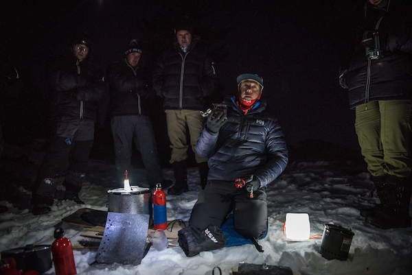
Photo Credit: Trent Bona/Mevyn Creative
2 Wheel-Drive Accessible Locations
KEBLER PASS
Kebler Pass Rd., also known as County Rd. 12, is an important thoroughfare during the summer. It is opened on Memorial Day each year and closes at the end of hunting season in late November depending on snowfall. It goes from Whiterock Ave. in the Town of Crested Butte, over Kebler Pass, and down to State Highway 133 below McClure Pass. This mostly gravel road is kept in very good condition with grading and mag chloride applications to keep down dust.
Just below Kebler Pass is the cutoff for Ohio Pass Rd. This is another well-maintained 2wd gravel road that allows a different route to Gunnison in the summer and fall. The aspens on both of these roads are something to see when they’re in peak color.
Some other options for 2wd accessible shooting locations off this road include Lost Lakes Campground, Irwin, Horseranch Park, and Erickson Springs Campground.
From winter shoot on Kebler Pass. Photo Credit: Trent Bona/Mevyn Creative
TAYLOR PARK AND TAYLOR RIVER CANYON
Taylor Park is known as motorized mecca for dirtbikes, ATVs, and 4 wheelers during the summer. The Taylor River Road leaves the main highway at Almont and is paved for 25 miles to the Cottonwood Pass turnoff. Cottonwood Pass is a main access road to Chaffee County and Buena Vista during the summer, but is closed through the summer of 2018 for maintenance and construction.
Above Taylor Reservoir the road turns to 2wd friendly gravel. You can connect lots of easily accessible roads back to Taylor Canyon by taking Rocky Brook Rd. to Spring Creek Rd. and back down to Taylor River Rd.
From the Taylor Reservoir you can also take the road to the small town of Tincup and then take this road over Cumberland Pass to Ohio City and Pitkin. All of this is on 2wd gravel roads.
Doctor Park trail in Taylor Canyon
OHIO CITY AND PITKIN
While only the main road in this area is 2wd friendly the small former mining towns of Pitkin and Ohio City are quaint and beautiful spots dripping with old timey charm. Quartz Creek runs along much of this road is a prize trout stream with easy access.
CRESTED BUTTE DRAINAGES
The towns of Crested Butte and Mt. Crested Butte are located in the Slate and East River Drainages. In addition to these two river systems, three tributaries come from the mountains to meet these rivers and each has a road with limited 2wd access.
Slate River Rd. leaves the main road in between Crested Butte and Mt. Crested Butte. At mile 7.5 is when the road becomes inaccessible to most sedans. Vehicles with higher clearance (not necessarily 4wd) can continue for another couple miles but be aware of water bars and steeper spots on this section. All the side roads off Slate River Rd. are 4wd, but there are several waterfalls and picturesque spots within easy walking distance.
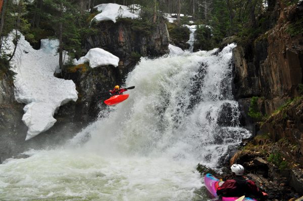
The waterfalls on Oh-Be-Joyful are popular with photographers and kayakers alike.
Gothic Rd. is the continuation of Highway 135 between Crested Butte and Gunnison. Leaving Crested Butte this paved road continues to the Snodgrass Trailhead where it turns to gravel. It remains 2wd friendly into the ghost town of Gothic, now the home of Rocky Mountain Biological Labratories, and further to about the Rustler’s Gulch Trailhead. Like Slate River Rd. you can continue past with a higher clearance vehicle as long as it’s not wet. Just before Emerald Lake and Schofield Pass there is a tight section that may unnerve some folks. This road connects to Slate River Rd. just after Schofield Pass to make a loop back to town.
In between these two roads is Washington Gulch Rd. This road takes you to the top of Elkton, an abandoned mining town, where it turns to 4wd at a well-marked sign. This is one of the best places to view wildflowers, especially near the top at the Trail 403 trailhead.
Trail 403. Photo Credit: Nathan Bilow
Brush Creek Rd. is located in a smaller drainage that has it’s headwaters between Crested Butte and Aspen. This road is only 2wd friendly for the first 4 miles and quickly deteriorates after the intersection with West Brush Creek Rd. and Middle Brush Creek Rd. Some good shooting locations off of Brush Creek Rd. include the Ditch Trail along the back of Crested Butte Mountain, and Strand Hill which appears above the right side as you drive along the ranchland.
Cement Creek Rd. is located 7 miles south of Crested Butte in the small neighborhood of CB South. Turn off the highway and follow the road for 7 miles until you reach the Deadman’s Gulch Trailhead and the road turns to 4wd. Lot’s of private property borders this road in the upper meadow so consult the Gunnison County Assessor Database to make sure you’re legal.
4×4 Accessible Locations
Aside from those 2wd locations that turn into 4×4 roads mentioned above, there are many other service roads that criss-cross the valley and require clearance and 4wd. Some of these places are the prettiest in the valley and the chances are, if you’re looking to come out for a shoot, you may find yourself wanting to access these areas. Below are some of the most common 4×4 accessible areas with roads rated on a 1-5 scale with 5 being the most difficult. For measure, a road rated as a 3 is the max for a stock 4×4 like a Toyota 4runner or Nissan Frontier.
PARADISE DIVIDE LOOP (2)
The Paradise Divide Loop is comprised of driving either Slate River Rd or Washington Gulch Rd. to the top of Paradise Divide which is a gap in the watershed between the East, Crystal, and Slate rivers. To return come out Gothic Rd. over Schofield Pass. You may never have to put your vehicle in 4wd on this road, but you will certainly appreciate a bit of clearance. There are also several steep and narrow parts on this road and there can be a lot of traffic during peak summer season.
DEVIL’S PUNCHBOWLS (5)
We don’t recommend driving to the Devil’s Punchbowls, although you can get close. The road alongside is one of the scariest in the valley and narrow, short 4wd vehicles are recommended. An easier way to reach them is to park at the large yellow warning sign in the ghost town of Schofield and walk the mile down to the Punchbowls. Bring sandals for the creek crossing or prepare to get your feet wet. From Crested Butte drive Gothic Rd. through Mt. Crested Butte and Gothic, over Schofield Pass and past the West Maroon Trailhead. Continue through the meadow until you reach the sign.
MIRROR LAKE AND TINCUP PASS (3)
From the town of Tincup in Taylor Park the Tincup Pass Rd heads up and over the Continental Divide into another ghost town called St. Elmo. Mirror Lake is only a couple miles outside Tincup and the road is bumpy but not steep or rutted. Once at Mirror Lake the road gets progressively rougher until it reaches the Pass. If you are planning on heading down the other side the road gets much better in a hurry, but it’s still 4-wheeling.
HARTMAN ROCKS (1)
Hartman Rocks is criss-crossed with several BLM roads, many of which are usually in good condition outside of the mud season. A bit of clearance is nice to have to get around on the main roads, but it’s not uncommon to see a Subaru or other light SUV’s cruising around.
Photo Credit: Matt Burt
BRUSH CREEK (3-5)
As mentioned in the 2wd section, Brush Creek Rd., also known as Pearl Pass Rd., turns rough after the intersection with West Brush Creek Rd. and Middle Brush Creek Rd. West Brush Creek Rd. is a 2 and can be driven all the way to the end with one creek crossing. Middle Brush Creek Rd. is also a 3 until you get close to Cumberland Basin. From here to Aspen it gets progressively tougher and travel is not recommended without short, narrow, high-clearance vehicles.
Jeep/Snowmobile/ATV Rentals
Because of the time of year or the condition of the roads, you may want to consider renting a Jeep, snowmobile, or ATV during your shoot. Click the button below to browse our partner listings for rental companies.
Activities and Events
If you’re looking for something to do outside of your shoot, or you’re interested in the best places to shoot any of the amazing recreational or cultural activities in our valley then check out our Activities page. Also, if you’re curious about events in the area you can browse our Events Calendar for the latest in music, arts, clinics, races and more.
Weather and Seasonal Considerations
The Gunnison Valley is a diverse landscape ranging from sagebrush desert to alpine tundra and most everything in between. Depending on the time of year that you visit you may find some shooting locations buried in snow while others that don’t receive as much snowfall are completely accessible. Here are some general tips on climate and seasonal considerations based on the time of year.
Summer
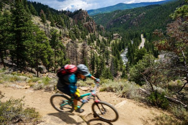
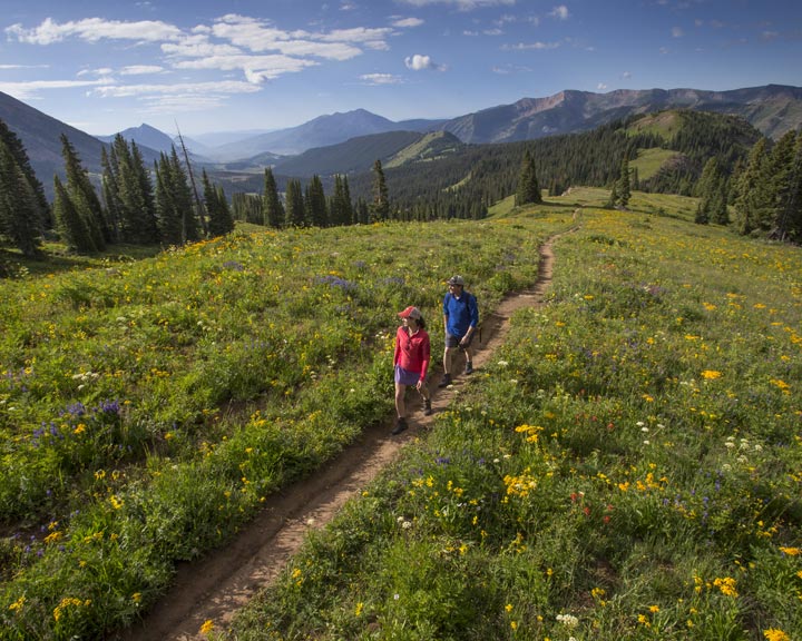
Summer is the busiest time of year in the Gunnison Valley and the height of wildflower season in Crested Butte.
Summer starts for us around Memorial Day when the 2wd access roads that are closed during the winter are plowed and opened to the public. During most years this allows access to the Taylor Park area and Kebler Pass. Many 4wd access roads are not plowed and are only opened once the snow has melted. Some roads, like Schofield Pass may not be accessible until August if we have a heavy snow year, but in general most are open by the end of June at the latest.
This is the mountains so summertime afternoon thunderstorms can be a daily occurrence from June-August in the north end of the valley. Lower down in Gunnison is often hot, with an average daily high of 79 degrees in July. The benefit is that Gunnison typically stays drier, so if it’s storming up north you can escape down south.
Photo Credit: Justin Cash
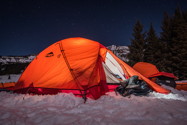
Winter
Winter means snow in the Gunnison Valley. Our snowpack in the north end of the valley will generally start to develop in late October or early November. By December most of the valley is covered in snow, but once again Gunnison typically receives less. Bluebird days are the norm, not the exception and even after a heavy snow we often have clear skies the next day.
During this time most of the gravel roads in the area are closed to automobile traffic and snowmobiles, skis, fat bikes, or snowshoes are the handiest modes of transportation.
Typical snowfall in Gunnison is around 45″ per year, and the Town of Crested Butte averages 175″. If you’re looking for ridiculous amounts of snow try the Kebler Pass area and the small town of Irwin get 450″ per year, but is only accessible via snowmobile or snowcat.
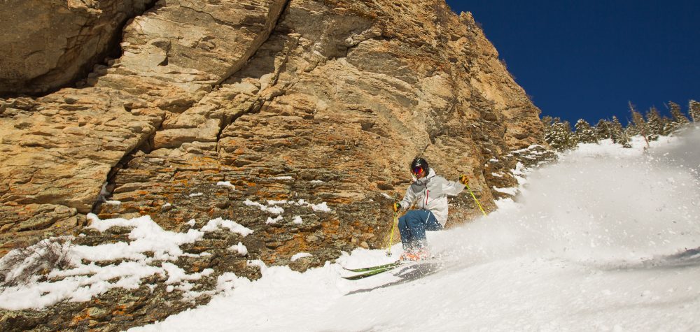
Photo Credit: Justin Cash
Spring
Spring can be an interesting time of year in the Gunnison Valley. The north end experiences a “mud season” as snow goes through a freeze/thaw cycle each day. This keeps access to most roads closed through May and even into the summer.
If you are visiting in the spring, Gunnison is your best bet. The rivers are starting to rise and most of the snow is melted in Gunnison around mid-April. The temperatures are pleasant during the day and usually hover in the low 60’s. Hartman Rocks, with it’s funky granite formations and Joshua Tree feel, is a great place to shoot during this season.
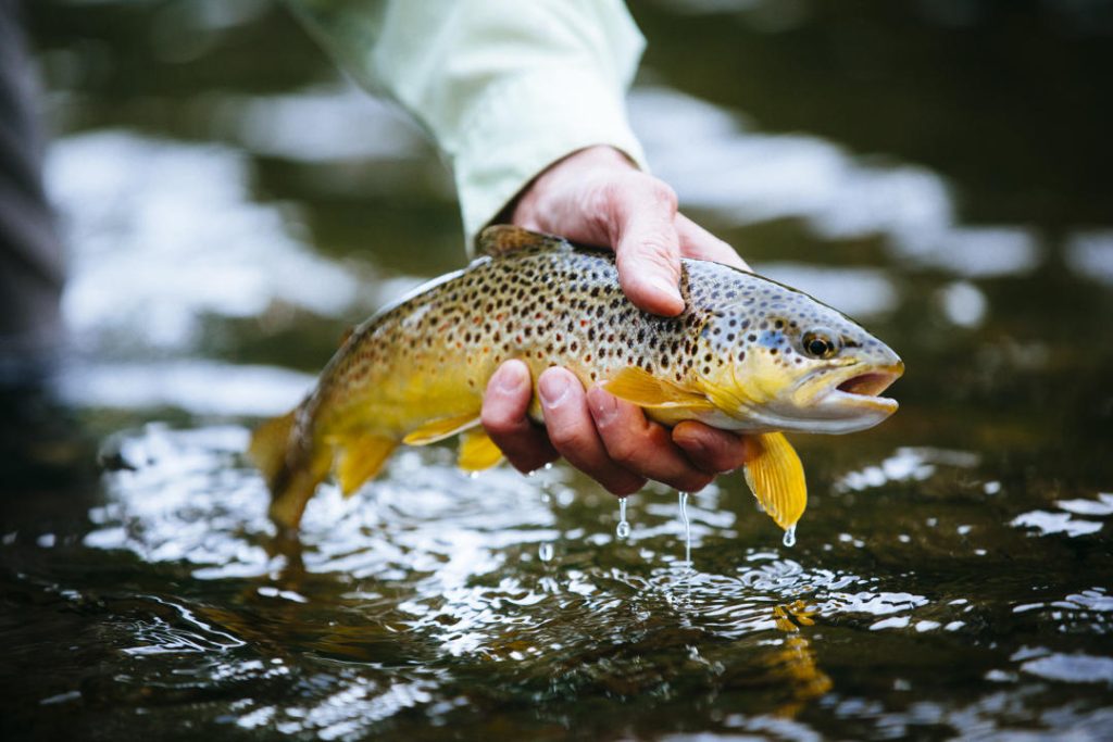
Photo Credit: Justin Cash
Fall
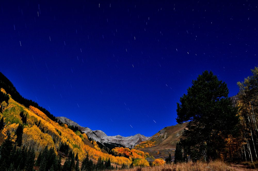
Fall is hunting season so make sure you have an abundance of blaze orange before shooting this time of year. Our peak foliage is usually in mid-September and during this time our aspens are ablaze in yellow. Kebler Pass is home to the second largest aspen grove in the world and is a popular spot among photographers and videographers.
Fall is also a bit drier. Temperatures in the north end of the valley will dip below freezing each night, but daytime temps are a bit more tolerable. Most of the road access in the valley is open until October or later each year, and many of the roads that are closed during the winter will be open until the end of hunting season in late November.