Gravel Biking in Gunnison and Crested Butte
Visit Gunnison and Crested Butte for scenic and varied Colorado gravel biking:
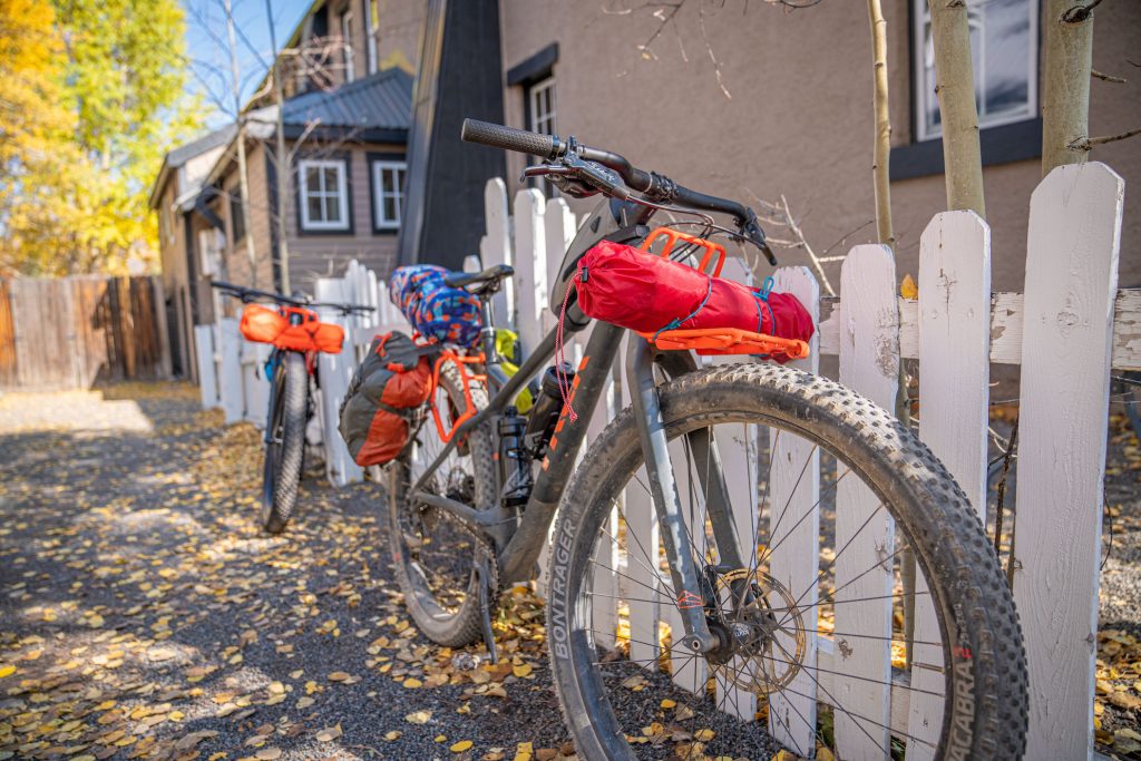
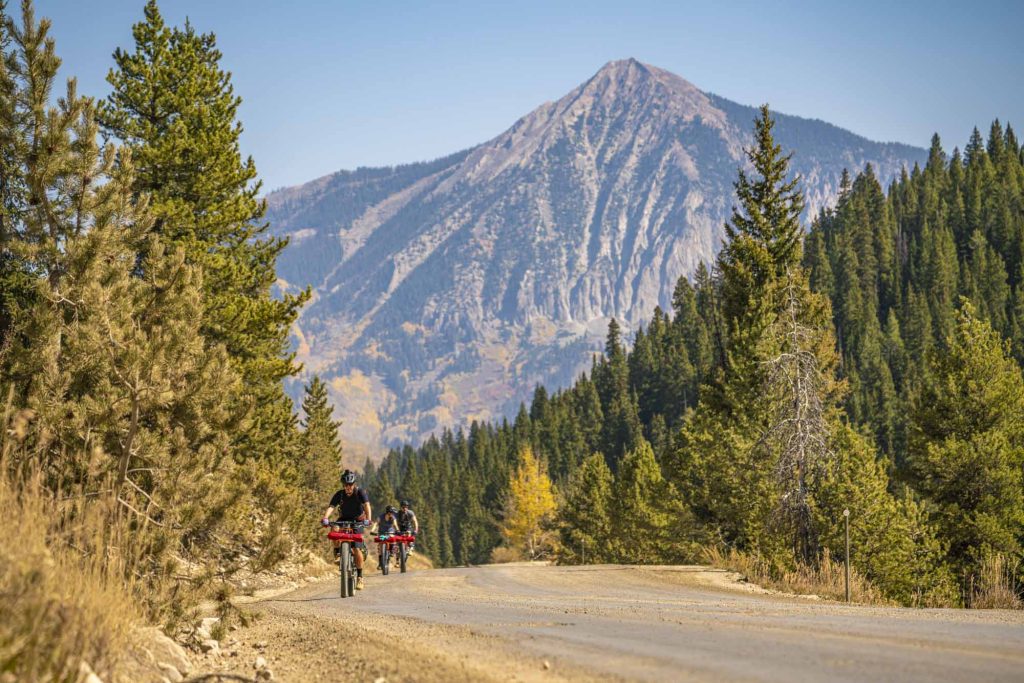
Gravel biking in Gunnison and Crested Butte offers hundreds of miles of scenic riding on dirt roads, mellow singletrack, and quiet pavement, making it a relaxed alternative to the area’s famous singletrack. With routes ranging from beginner-friendly loops to long, challenging mountain passes, there’s a gravel ride here for every ability level.
- Endless options: Over 1,100 miles of gravel riding on Forest Service roads alone, plus additional BLM and county routes.
- Standout routes: Maggie Pass, Waunita Pass, Spring Creek–Taylor Canyon, Lily Lake, and Paradise Divide offer iconic scenery and varied terrain.
______________________________________________________________________________________
Gunnison and Crested Butte have hundreds of miles of biking, including road biking, mountain biking or gravel biking. Though Crested Butte and Gunnison are known for mountain biking, gravel biking has taken off in popularity in Colorado in recent years. It encompasses a few kinds of terrain, from dirt and paved roads to mellow singletrack. Gravel riding provides a more relaxed bike ride than some of the rides on our 750+ miles of singletrack and is a good way to take in the scenery. There are 1,169 miles of gravel riding in Crested Butte and Gunnison on National Forest Service roads alone. Other public lands such as the Bureau of Land Management and county roads provide hundreds more. There are plenty of options for your gravel biking adventure. On this page we will share a few gravel routes in Gunnison and Crested Butte to try out on your Colorado vacation.
Where Can I Ride My Gravel Bike in Gunnison?
Gravel riding areas in Gunnison include Ohio Creek, Signal Peak and the Almont and Taylor Park area.
What Gravel Rides in Gunnison are Intermediate/Advanced?
Maggie Pass
Distance: 37 miles
Difficulty: Intermediate
This ride is located outside the city of Gunnison near Cranor Hill. It goes over Maggie Pass and eventually meets Ohio Creek Road. Ride Highway 135 north out of Gunnison and turn right (east) onto the Highway 135 frontage road. Then turn right onto County Road 10. At the juncture with County Road 743, bear left to continue on County Road 10. Ride north on Highway 135 for about .25 mile and then turn left (west) onto County Road 8. At the juncture with Ohio Creek Road (also known as County Road 730), you have two options. For a shorter ride, turn left (south) on Ohio Creek Road, then right (south) on Highway 135, which will take you back to Gunnison. For a longer ride, turn right (north) on Ohio Creek Road and link County Road 7 and 818 for a counterclockwise loop that will bring you back to Ohio Creek Road. Take Ohio Creek Road south to Highway 135 and continue south back towards Gunnison.
Signal Peak
Distance: 30 miles
Difficulty: Intermediate/Advanced
Signal Peak is a trail system located adjacent to Gunnison and Western Colorado University. Trails can be hiked or biked, but no motorized travel is allowed. Much of this route is on smooth, mostly flowy singletrack trail. Start on the south end of Canal trail just east of the university. Take Canal Trail to Contour Trail, then ride the Signal Peak Road 3122 north to Duane’s World. Take a left on the Rim Trail, then bear right at the fork to get on the Northwoods trail. From there, turn left (east) onto the Powerline Road. Turn left (north) on Sheep Gulch Road, then left (west) on the Lost Canyon Road. Lost Canyon Road will take you to County Road 10 (Cranor Hill Road), and you’ll continue south onto Highway 135 to get back to Gunnison.
Ohio City to Taylor Park
Distance: 34 miles
Difficulty: Intermediate/Advanced
This one-way ride from Parlin to Taylor Park takes you to several old mining towns. Start at the intersection of County Road 76 and Highway 50, about 12 miles east of Gunnison. Ride County Road 76 east for about 15 miles, past Ohio City and through Pitkin. Then take the Cumberland Pass Road (County Road 765) north to Tincup. From Tincup head to Taylor Park. This ride can be shuttled or done as an out-and-back for double the mileage. It is scenic and goes through areas that aren’t highly populated. Ohio City and Pitkin are small towns situated outside of Gunnison. Pitkin was once a mining town and still offers a look into the mining history of the area thanks to the original buildings that are still in good repair. Ohio City was also once a mining town. Today it has a small population, and its town hall has been classified as a historic county landmark. The town of Tincup also began as a mining town. Today it has a handful of year-round residents and largely resembles what it looked like in the past; most of the buildings are original structures.
Lost Canyon to Almont
Distance: 33 miles
Difficulty: Intermediate/Advanced
To access this route, head north on Highway 135 from Gunnison and turn right onto the frontage road to County Road 10 (Cranor Hill Road). Just north of Cranor Hill Ski Area, bear right at the fork to turn onto Lost Canyon Road (County Road 743). Stay left at the fork with One Mile Road 586. Bear left to get onto Esty Lane, which will turn into Forest Service Road 7743 and take you north into Almont. From Almont, ride south on Highway 135 to finish where you started. This ride is a mix of dirt and pavement.
What Gravel Rides in Gunnison are Advanced?
Waunita Pass
Distance: 44 miles
Difficulty: Advanced
Waunita Pass is located east of Gunnison off Highway 50. Start this ride in the tiny town of Parlin on Highway 50, 12 miles east of Gunnison. Ride County Road 76 east for about 15 miles, past Ohio City and ending in Pitkin, another very small town. In Pitkin turn right (south) to Waunita Pass Road (County Road 763), which runs along Hot Springs Creek for a few miles. Finally, turn right (west) onto County Road 887, which will take you past Waunita Hot Springs and Hot Springs Reservoir. From the reservoir, ride about 7 more miles to get back to where you started on Highway 50.
Spring Creek to Taylor Canyon
Distance: 53 miles
Difficulty: Advanced
This long ride is a loop with several climbs and a downhill descent. It’s mostly dirt with some pavement. Spring Creek is located near Almont, Colorado. From Almont, head east on County Road 742 (the Taylor Canyon road). Drive seven miles and turn left (north) onto County Road 744, also known as Spring Creek Road. This is where you’ll start riding. Climb for 12 miles up Spring Creek Road. Just before you reach Spring Creek Reservoir, turn right (east) onto County Road 748 (Rocky Brook Road). After a few more miles, you’ll cross the Taylor River and turn right (south) onto County Road 742 again, which descends for about 20 miles back to where you started. You’ll pass by beautiful Taylor Park Reservoir on your way down.
Where Can I Ride My Gravel Bike in Crested Butte?
Places to gravel bike in Crested Butte include the area around Kebler Pass and the Schofield Pass area.
What is a Beginner or Intermediate Gravel Ride in Crested Butte?
Lily Lake
Distance: 21 miles
Difficulty: Beginner/Intermediate
This ride is mostly gravel and is about 20 miles long. It begins in the town of Crested Butte on Whiterock Avenue. Heading west out of town, this road becomes Kebler Pass Road. Turn left (south) onto Splains Gulch (County Road 885) which becomes Lily Lake Trail #639. You’ll ride around picturesque Lily Lake. The trail curves to the northwest and intersects with Ohio Creek Road. Turn right (north) and if desired, hop onto Kebler Wagon Trail, which parallels Kebler Pass Road until you get back to the Splain’s Gulch turn. Take Kebler Pass Road east back to Crested Butte.
What is an Advanced Gravel Ride in Crested Butte?
Paradise Divide
Distance: 30 miles
Difficulty: Advanced
Begin on Gothic Road headed north out of the town of Crested Butte. Turn left (west) onto Slate River Road. Part of this road is paved and will take you through the old mining town of Pittsburg. You’ll reach Paradise Divide a few miles after Pittsburg. From there, continue to Schofield Pass. After reaching Schofield Pass, you’ll descend Schofield Pass Road south past the townsite of Gothic. Gothic is the home of Rocky Mountain Biological Laboratory, one of the largest biological field stations in the world. Be cautious when riding in this area and stay on the road to avoid disturbing any experiments. Schofield Pass Road turns into Gothic Road and descends back to Crested Butte.
Planning your trip to Gunnison and Crested Butte
Gravel biking is just one of many fun things to do in Crested Butte and Gunnison. There is more than two million acres of public lands in the area and 1200 miles of trails to hike and bike. Some trails are also suitable for OHV and horseback riding. There are also opportunities to fish and boat in the area’s lakes and rivers. While you’re here, explore the four mountain towns in Gunnison Valley. After enjoying a day of biking check out the local restaurant and shopping options. Make sure you plan how to get here and where to stay, too.
