Town Profiles: Whitepine
Whitepine, one of Colorado’s historic ghost towns:
Whitepine, Colorado, is a well-preserved ghost town near the base of Monarch Pass that blends rich mining history with rugged outdoor adventure. Once a thriving silver and wartime mining hub, it’s now a quiet, seasonal destination for history buffs, mountain bikers, and off-road explorers.
- Historic ghost town: Whitepine played a key role in Colorado’s silver boom and WWII mining efforts before returning to a natural, lightly inhabited state.
- Outdoor recreation hub: Challenging mountain biking, scenic off-roading routes and alpine views make Whitepine a rewarding adventure destination.
- Remote and authentic: Limited access and preserved structures offer a rare glimpse into Colorado’s mining past, surrounded by wild landscapes.
______________________________________________________________________________________
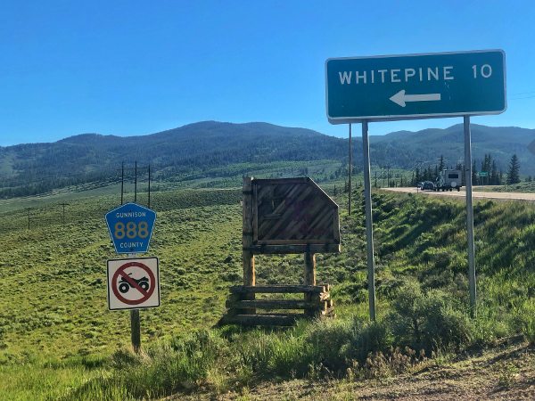
Whitepine, Colorado, is at the bottom of Monarch Pass on County Road 888, a few miles before the gas station at Sargents. This town was once a bustling mining town. Today, it has a small seasonal population and is a popular outdoor recreation spot. Whitepine is one of the few Colorado ghost towns that remains in its natural state. It outlasted many other ghost towns by remaining a mining town until shortly after World War II. Keep reading to learn more about Whitepine!
Where is Whitepine?
Whitepine is about 40 miles east of Gunnison. To get there, head east on U.S. Hwy 50 for 33 miles. Turn left onto County Road 88 and drive for about 10 miles.
The Silver Boom
In 1878, R.E. McBride and the Boon Brothers crossed the Continental Divide and formed a silver mining camp in the headwaters of the Tomichi River. The camp, and later town, was known as Whitepine. By the mining season of 1897, men and supplies began streaming into the camp. Mines, claims, and infrastructure were built to create a town.
Whitepine was never a “boom town” like other mining towns in Colorado. The location was hard to get to, and the terrain was harsh and prone to avalanches. However, it was still profitable. At one point, over 1,000 miners lived in Whitepine. At its height, the town boasted three major hotels, two sawmills, a post office and three saloons.
The Silver Panic
Like many mining towns in Colorado, the 1893 Silver Panic brought life in Whitepine to a halt. The Silver Panic caused silver to be demonetized and the markets to collapse. Whitepine was largely deserted by 1894. By 1910, only ten to fifteen people lived in Whitepine. This was Whitepine’s first life as a ghost town.
The War Effort
World Wars I and II brought a bit of life back to Whitepine. Akron Mining Company bought several claims in Whitepine in 1902. The desperate need for metals such as lead, zinc, and copper ramped up mining activity and production throughout WWI. During WWII, the mines owned by Akron were sold to the Callahan Mining Company.
The Callahan Mining Company sent lead, zinc and copper over the Continental Divide for the WWII war effort. The surge in jobs started a development boom with new housing for miners and their families. A mill was built in 1947.
In the late 1940s or early 1950s, Callahan Mining Company installed a tow rope and engine to create a small ski area. This ski area with a 300′ vertical drop was one of just a few in Colorado at the time. A flotation mill was built in 1947 and ran until 1953. Post-WWII brought falling prices and a lack of demand for ore, reinstating Whitepine as a ghost town.
Whitepine Today
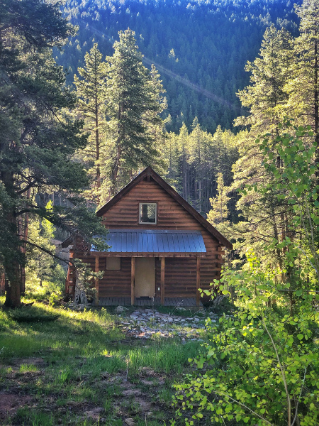
Today, a few cabins remain in Whitepine. They are occupied by a handful of summer residents. Whitepine can only be accessed in the winter by snowmobile or ski. Those interested in history can visit the Whitepine Cemetery on a hill outside of town. A fence with a sign announces it. About 35 people are buried there, and it is managed by the Sargents Historical Society.
Outdoor Recreation in Whitepine
Mountain Biking
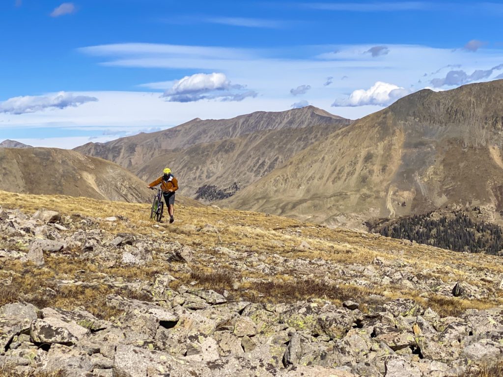
Outdoor recreation is the most popular reason to visit Whitepine today. Intrepid mountain bikers can tackle the challenging Canyon Creek Loop to see the ghost town. This lesser-known trail is a 20-mile high-altitude backcountry loop. Expert riders looking for stunning views or solitude will enjoy this trail. The ride begins near Snowblind Campground. Drive east from Gunnison on Highway 50 for 33 miles before turning left on Country Road 888 and driving another eight miles to get to the trailhead.
The loop should be ridden counterclockwise. Head north on County Road 888 past Whitepine for the first few miles. Go left at the trail marker for Canyon Creek trail. This part of the trail is characterized by small rocks, often known as baby heads, that are difficult to navigate through. Eventually, you will have to get off your bike and carry it to the top.
Hike-a-bike for eight miles to 12,600′ near the peak of Granite Mountain. Enjoy views of the Sawatch Range and the Collegiate Peaks before heading downhill. The remaining 12 miles of the trail are a moderate descent into the trees back to the trailhead.
Off-roading
Off-roading on the surrounding trail systems, including those between Waunita, Pitkin, and Taylor Park, is another popular activity near Whitepine. One scenic off-roading route near Whitepine is the Alpine Tunnel. This route begins in Pitkin and goes up Cumberland Pass. Head north in Pitkin to Cumberland Pass Road (FSR 765). From there, take Alpine Tunnel Road (FSR 839).
The rocky road winds upward in a series of switchbacks, revealing stunning views along the way. As you climb, you’ll pass two historic railroad water tanks. The drive remains relatively easy until you near the top, where the terrain becomes more challenging. To reach the Alpine Tunnel, the road traverses a narrow terrace pressed against a sheer cliff face known as the Palisades. On the outer edge, a manmade wall of mortared stone forms a protective barrier.
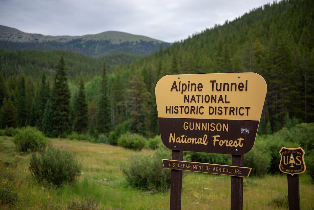
Remarkably, this wall remains much as it was when first constructed in the 1880s. At the tunnel, explore reproducted buildings from when the railroad was operating in the Gunnison Valley. Though the tunnel itself is closed, you can walk to the mouth of it and appreciate the effort that went into creating such a large tunnel in the mountains.
Old Monarch Pass Road is another well-maintained off-roading route near Whitepine. It’s a great bypass to US 50 over Monarch Pass if you have the time and inclination to see a different side of the Divide. From Gunnison, head east on Highway 50 towards Monarch Pass. About 34 miles from Gunnison, just before reaching the top of modern Monarch Pass, turn right onto Old Monarch Pass Road (Forest Service Road 237). This scenic back road traces the route of the original highway before the newer pass was built.
The gravel road climbs steadily through dense spruce and fir forests, offering glimpses of the surrounding Sawatch Range. As you near the summit at 11,375 feet, the trees open up to reveal sweeping alpine views. From the top, you can either continue west to rejoin Highway 50 on the other side of the divide or turn around and retrace your route for another look at the stunning mountain scenery near Whitepine. Learn more about Colorado 4-wheeling vacations in the Gunnison Valley.
Plan a trip to the Gunnison Valley
Use our trip planning guide to plan a visit to Whitepine and the other mountain towns of the Gunnison Valley. Book flights, find a place to stay and explore things to do.
Explore the Gunnison Valley’s other small town profiles
Pitkin
Arrowhead and Western Gunnison County
Tincup
Powderhorn
