Snowshoeing in Crested Butte and Gunnison
Learn about snowshoeing in Gunnison and Crested Butte, Colorado:
Snowshoeing is an easy, affordable way to explore winter landscapes in Crested Butte and Gunnison, requiring minimal gear and experience. With groomed and ungroomed trails ranging from mellow meadows to scenic canyons, the Gunnison Valley offers snowshoeing options for all abilities.
- Accessible winter fun: Snowshoeing is beginner-friendly and available on many summer hiking trails throughout the valley.
- Plenty of trail choices: From Crested Butte Nordic and Snodgrass to Hartman Rocks and Van Tuyl Ranch, there are options for every skill level.
- Share and stay safe: Follow winter trail etiquette, respect groomed ski tracks and be aware of avalanche conditions when recreating outdoors.
______________________________________________________________________________________
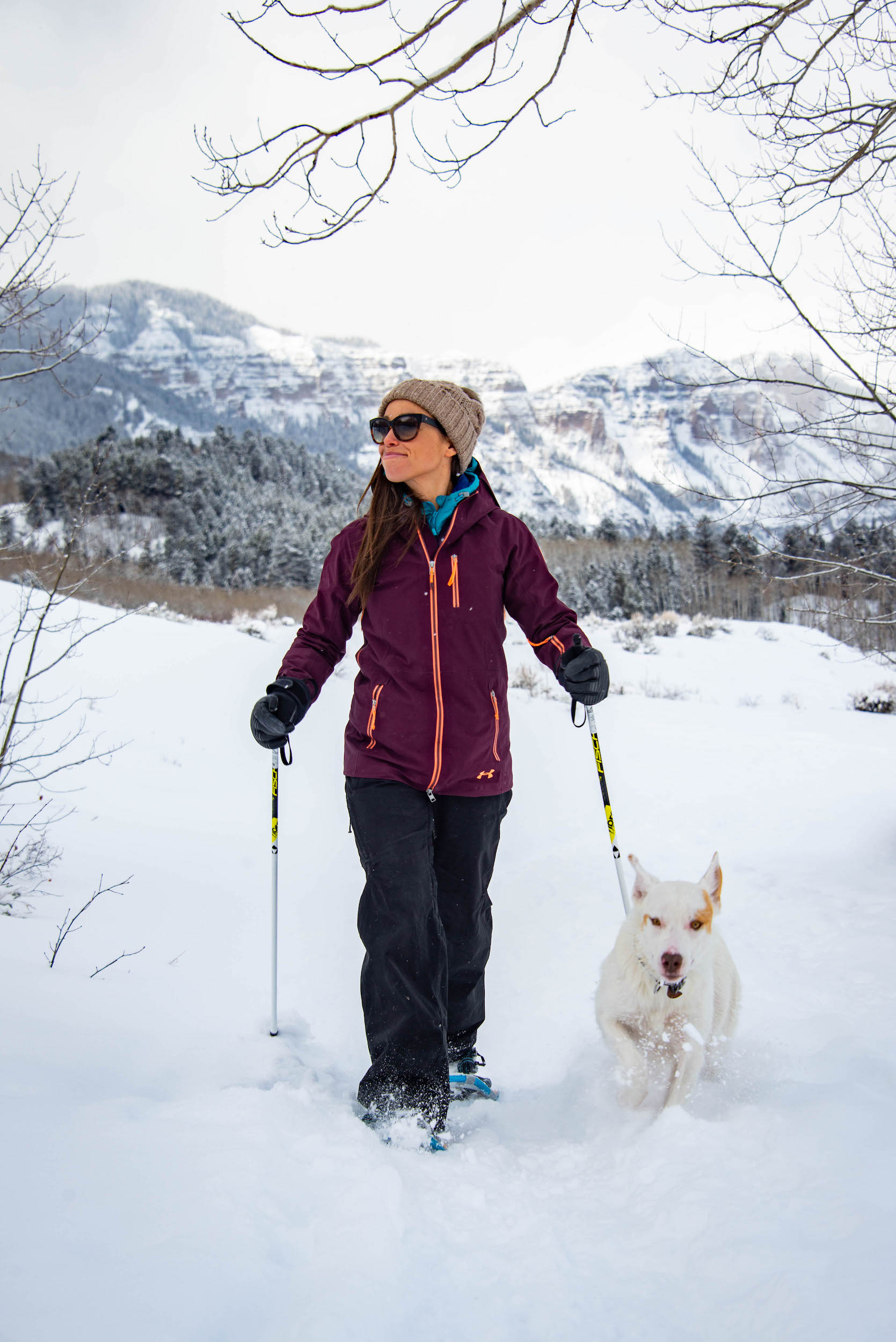
Crested Butte and Gunnison, Colorado, are known for access to winter sports. Snowshoeing is a mellow and easy way to get outside in the winter. Clothes that suit the weather, a decent pair of shoes and snowshoes are all you need. If you enjoy hiking and walking, give snowshoeing a try! Many summer hiking trails are available for snowshoeing in the winter, but we’ve created a list of a few of the best.
Crested Butte Snowshoeing
The Crested Butte Nordic Center has over 50 kilometers of groomed trails. There are even more that are ungroomed. Nearly any trail that can be hiked in the summer can also be snowshoed in the winter.
Crested Butte Nordic
The Crested Butte Nordic Center offers snowshoeing along its vast network of groomed trails surrounding Crested Butte. The Nordic Center grooms over 50 kilometers of trails for cross-country skiing that are also available for snowshoeing. These trails are close to town but offer a scenic and serene experience because they are on protected lands. Most trails require a pass. Please abide by all trail signs and display your pass at all times.
Some trails are also dog-friendly. You must get your pup a pass and display it at all times. You can also rent snowshoes from the Nordic Center, including boots and poles. Please stay out of the groomed parallel track while snowshoeing. This track is for classic skiing.
- Directions from Crested Butte: Several in-town access points exist. Peanut Lake Road, Town Ranch behind the Crested Butte Community Schools, and the Crested Butte Nordic building on 2nd Street and Belleview Avenue are the most popular.
Snodgrass
Snodgrass is about a 10-minute drive from Crested Butte up Gothic Road. This is one of the most popular places to snowshoe in the area. This groomed trail is easy and six-miles roundtrip. Be prepared to share the trail with Nordic skiers and fat bikers. Be mindful of others and share the trail. Enjoy views of Crested Butte Mountain, home to Crested Butte Mountain Resort, on your walk.
- Directions from Crested Butte: From the Four-Way Stop, travel north on Gothic Road for 4.3 miles to the Snodgrass Trailhead.
Cement Creek
Cement Creek is about seven miles south of Crested Butte. This trail is easy to intermediate in difficulty. Start with a .75-mile climb through a scenic and rocky canyon. This levels out into a large open meadow, unlike any other in the Crested Butte area. The climb up is steep, but the meadow is generally pretty easy to snowshoe. You could potentially encounter fat bikers and Nordic skiers in this area, too.
- Directions from Crested Butte: From the Four-Way Stop, travel south toward Gunnison on Colorado Highway 135. In seven miles, turn left onto Cement Creek Road. Drive straight for 3.8 miles to the winter trailhead and parking.
Gunnison Snowshoeing
The Gunnison Nordic Club grooms a few areas that can be snowshoed around Gunnison and outside of town. There are other, ungroomed trails to snowshoe too. Choose something mellow like Van Tuyl Ranch or something a little more adventurous like Hartman Rocks.
Mill Creek
Mill Creek is between Crested Butte and Gunnison. This local favorite offers intermediate to difficult snowshoeing. There are lots of trail options winding through the spruce and aspen groves. Gunnison Nordic grooms Mill Creek early in the season.
Grooming ceases later in the season when the snow starts to get deep. Check out the Gunnison Nordic grooming report to see when it was last groomed. You’re likely to see skiers, dogs and fat bikers while you’re out there.
- Directions from Gunnison: From the stoplight at the corner of U.S. Highway 50 and Colorado Highway 135, go north on Highway 135 for 3.5 miles. Turn left on Ohio Creek Road. In nine miles, turn left on Mill Creek Road. Follow Mill Creek Road for three miles until you reach the parking area.
Hartman Rocks
Hartman Rocks is a mountain biking, trail running, rock climbing and hiking mecca in the warmer seasons. Hartman Rocks offers snowshoeing for all abilities along a trail network about three miles south of Gunnison. Snowshoe with acres of shrubland, unique rock formations and endless views.
Hartman Rocks offers a more expansive snowshoeing experience than many places in the Gunnison Valley. Long loops and day trips are easy to piece together here on the 16 miles of roads that are groomed in winter. Check the Gunnison Nordic Club Instagram for grooming updates.
- Directions from Gunnison: Follow U.S. Highway 50 westward from the center of town. Just before crossing the Gunnison River, turn left on County Road 38 (Gold Basin Rd.). Follow this for a couple of miles to the Hartman Rocks parking area on the right. Access also exists off County Road 32 (McCabe Lane), a couple of miles further west down U.S. Highway 50.
Van Tuyl Ranch
Van Tuyl Ranch is northwest of Gunnison. These groomed trails run through open pastures on a working ranch. They are available for snowshoeing and Nordic skiing in the winter. These trails are relatively flat, making this is a great spot for beginners or anyone looking for a chill hike. Dogs are not permitted in this area.
- Directions from Gunnison: Follow Main Street from downtown north for one mile. Turn left on County Road 13A. Turn left onto Vulcan Street. Quick right onto Tincup Drive. Parking is available in CharMar Park. Cross the pedestrian bridge at the park to access the Van Tuyl Ranch trails. You can also access the trails via the north end of the Gunnison Middle School.
Winter Trails Etiquette in Crested Butte
Remember that avalanche danger is not limited to the skiers and splitboarders who venture into the backcountry to earn their turns. Recreating outside in the winter always presents potential avalanche danger. Please ensure you have the proper skills, knowledge and equipment necessary to stay safe. Prepare for sharing trails with other users by familiarizing yourself with winter trails etiquette.
Visit Crested Butte in Winter
When you visit Crested Butte in winter you can take advantage of these scenic snowshoe trails and more. Start planning your winter trip! Explore winter things to do, book flights, find a place to stay and more!
