Mountain Manners: A Scenic Hike Through Crested Butte’s History
Learn about Crested Butte’s mining history and how to stay safe while hiking near old mining camps and equipment:
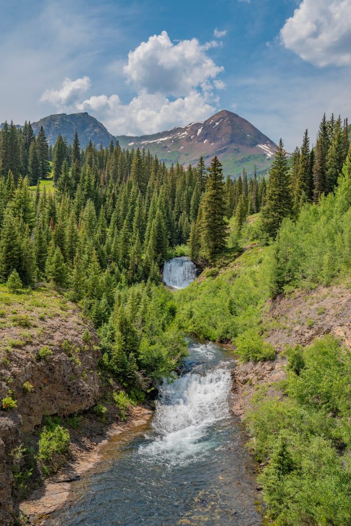
Crested Butte’s mountains are rich with mining history, but abandoned and inactive mines are extremely dangerous and should only be viewed from a safe distance. The Poverty Gulch to Baxter Basin loop offers a scenic, moderately difficult hike where you can appreciate historic mining sites, geology and sweeping alpine views without putting yourself at risk.
- Abandoned mines are hazardous; admire them from afar and visit local museums to learn more about mining history.
- The Poverty Gulch-Baxter Basin loop is a 5.5-mile, moderately difficult hike with about 1,200 feet of elevation gain.
- The route features alpine scenery, glacial terrain and views of historic mines, including the Augusta Mine.
______________________________________________________________________________________
Crested Butte’s Mining History
Crested Butte was founded in 1880 as a supply town for the hard rock mines in the surrounding mountains before becoming a coal mining town in its own right as the hard rock mining wound down. Because of that, the mountains around town are littered with old, inactive and abandoned mines.
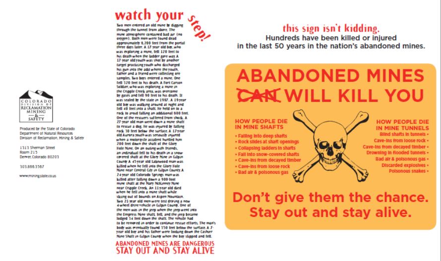
Mines in the backcountry may be tempting for amateur archaeologists and geologists to check out, but the mines themselves are very dangerous. Hundreds of people have been killed or injured in the last 50 years in abandoned mines around the country. From poisonous gases to falls, cave-ins, and old dynamite, there are hazards in mines that make abandoned and inactive mines extremely dangerous. The State of Colorado Department of Natural Resources Division of Reclamation, Mining, and Safety produced this brochure describing the hazards of abandoned and inactive mines. The key point is, don’t go near them.
If you’re interested in the history of mining and railroads in Crested Butte and the Gunnison Valley and would like to see some mining artifacts up close, visit the museums in the Gunnison Valley. Don’t go looking for your own artifacts near abandoned and inactive mines.
If you want to go on a beautiful hike and observe some of the local mines from afar, here’s a great hike that will take you around some beautiful country in the Valley.
Poverty Gulch and Baxter Basin Hike
Work brought me to Poverty Gulch and Baxter Basin when I collected water quality samples for the Coal Creek Watershed Coalition. But the views and solitude have brought me back more times than I care to admit!
The Poverty Gulch to Baxter Basin hike loop is about 5.5 miles. The hike ascends just under 1,200 feet in 2.4 miles, with some longer traverses over loose scree. Decommissioned roads make route finding fairly simple in the alpine terrain. The descent is similar to the ascent (so it’s reasonable to hike this trail in both directions). Overall, the hike is moderately difficult.
The Trailhead
From Crested Butte, head toward Mount Crested Butte. After crossing the Slate River near the cemetery, take the first left onto Slate River Road. Continue on Slate River Road for about 7.5 miles. Turn left onto Poverty Gulch Road.
If you don’t have a four-wheel drive vehicle with high clearance or lack the advanced driving skills to navigate the river crossing, large water bars, and rock features, you can hike from the junction of Slate River Road and Poverty Gulch. This option increases the length of the hike to just under nine miles. When I have the time, I prefer to walk from Slate River Road.
As you ford the Slate River, be sure to respect private property and stay on the road near the river crossing and for the next mile or so as you head up Poverty Gulch. Continue on Poverty Gulch Road for approximately two miles. You’ll park near a switchback below the road closure.
The Hike
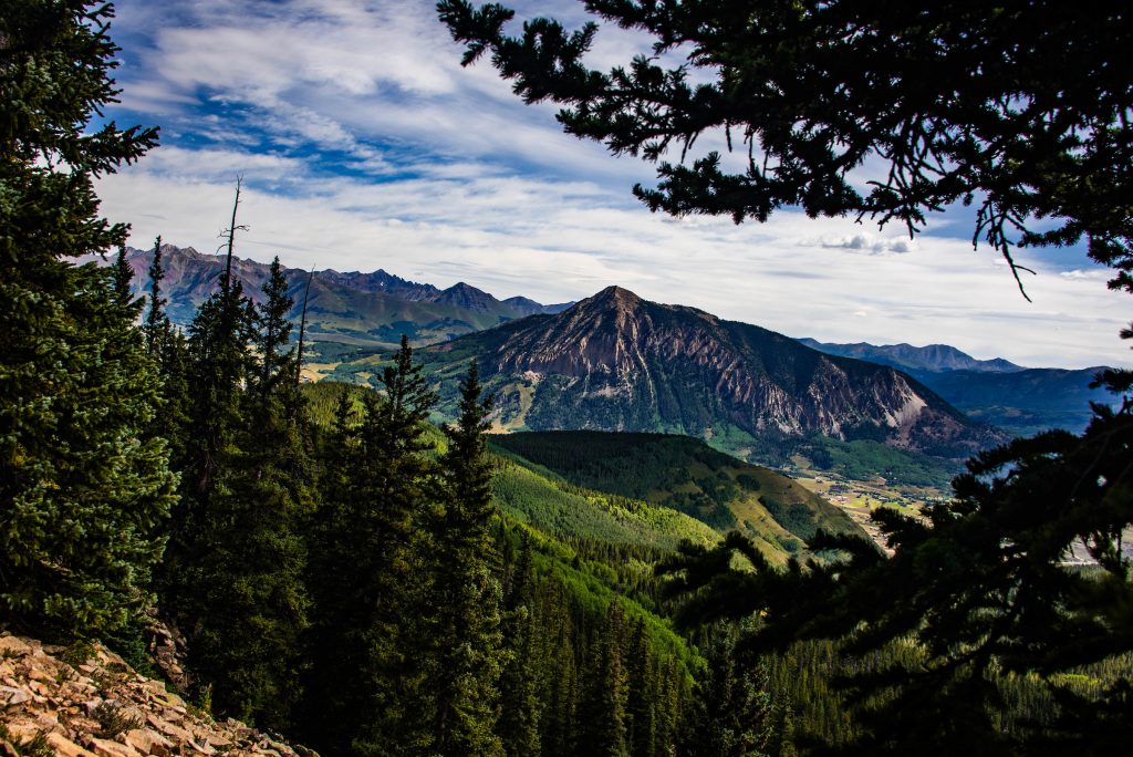
From the parking spot, follow the old road as it switchbacks beneath Purple Mountain, Mineral Point and Augusta Mountain. The Augusta Mine is located about two miles up the trail.
From the Augusta Mine, walk back down the road about 300 feet to the small trail that climbs through loose scree to the saddle between Cascade Mountain and Mineral Point. The saddle is a beautiful place to take a break, enjoy the views and eat a hearty snack!
From the saddle, drop into Baxter Basin for the descent. There are several more abandoned mines in this area. The road meanders through dramatic topography that is evidence of past glacial erosion and more recent mass wasting; it’s straight out of a geology textbook!
Your knees or ankles may begin to creak as the trail passes under Cascade Mountain on the final descent into Poverty Gulch. Rather than complain, be grateful that you’re not hauling around a pack of pick axes and dynamite! It’s astounding how hard the miners worked.
Hikers who park near the end of Poverty Gulch Road will continue up the road for about a half mile to the car. Hikers who opted out of crossing the Slate River have just under two miles left to return to the junction of Poverty Gulch and Slate River Roads (but it’s all downhill!).
Tools for Your Hike
- Review the State of Colorado Department of Natural Resources Division of Reclamation, Mining, and Safety Mine Safety Brochure.
Editor’s Note: Ashley Bembenek is a water quality expert who works with the Coal Creek Watershed Coalition, a local non-profit organization that works to protect and restore the watersheds surrounding Crested Butte. She offered to write this post for those of you who are interested in seeing some of the abandoned mines in the upper Gunnison Valley so that you can see them safely. We think it sounds like a pretty great hike!
